
Lest you think all we’re doing is eating and drinking………..we’ve taken some time to visit several Florida State Parks which are definitely out of our normal driving realm being in the keys. Let me preface with saying there are more State Parks than what I’m blogging about, but we only squeezed in four during our time in the Florida Keys.
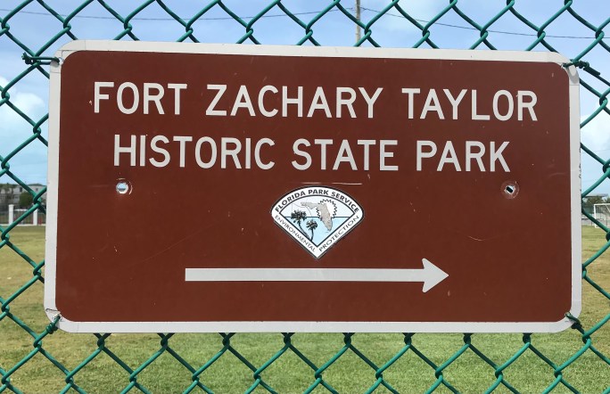
First up – Fort Zachary Taylor Historic State Park.
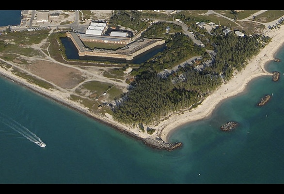
It is the southernmost Civil War fortress with construction begun in 1845. The fort stayed on active duty status through 1947 with the facility encompassing 87 acres.

The fort is named after our 12th president Zachary Taylor, shortly after his sudden death in office.
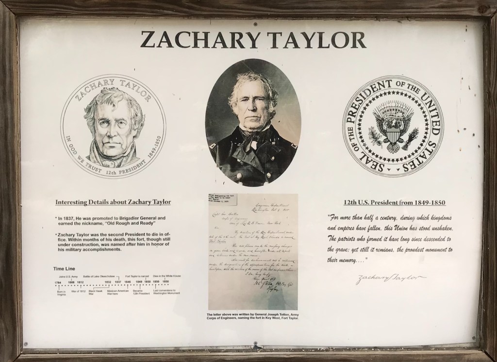
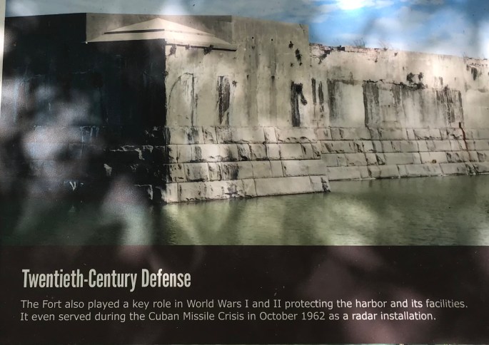
The fort was used at the outset of the U.S. Civil War with orders to prevent the fort from falling into Confederate hands. It was heavily used again during the 1898 Spanish-American War, WWI, WWII and the Cuban Missile Crisis.
Upon some construction work, a discovery was made. Turned out, it was the location of the largest cache of Civil War era cannons. At the time it was easier to use them for ‘fill’ than to haul them away.


It was definitely hot the day we visited and w.i.n.d.y.
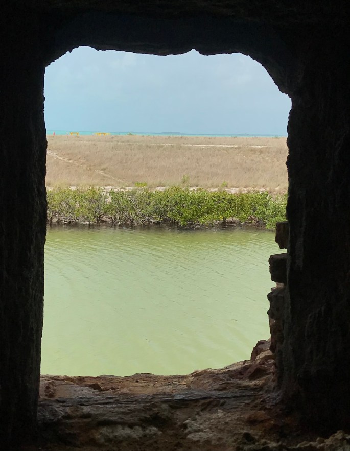
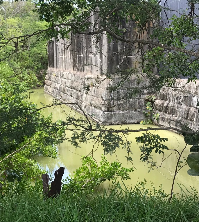
Another line of defense was a moat. The photo above is looking towards the Gulf with the photo below faced the city.
There was also a sprawling beach of sand & pebbles and nearby breakwaters teeming with tropical fish. Next visit, we’re definitely going to spend a few hours relaxing here. It looked awesome and attendance was limited with the capacity of the state park, so it didn’t appear it would get overrun. Basically the park ranger (and said parking spots) limited the number of guests coming in. The beach area is the sandy, curvy area on the right of the photo below.
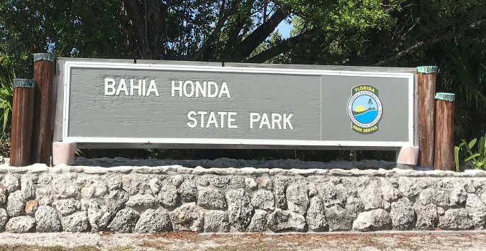
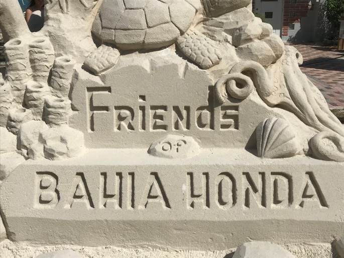
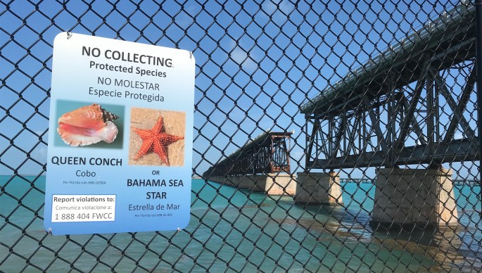
Second park visited was Bahia Honda State Park – a few miles above Key West in the lower keys and covers 524 acres.
Bahia Honda means deep bay in Spanish and it is close to the end of the 7 mile bridge. The channel at the island’s west end is one of the deepest natural channels in the Keys. Look at the beautiful blue turquoise waters. BTW this is looking west.
While the visitor center was closed, this sand sculpture was outside of the building. Definitely took someone a lot of time. Both sides were very detailed.
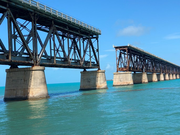
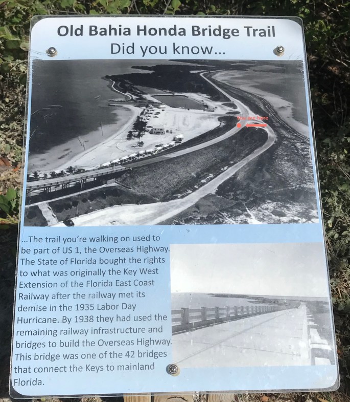
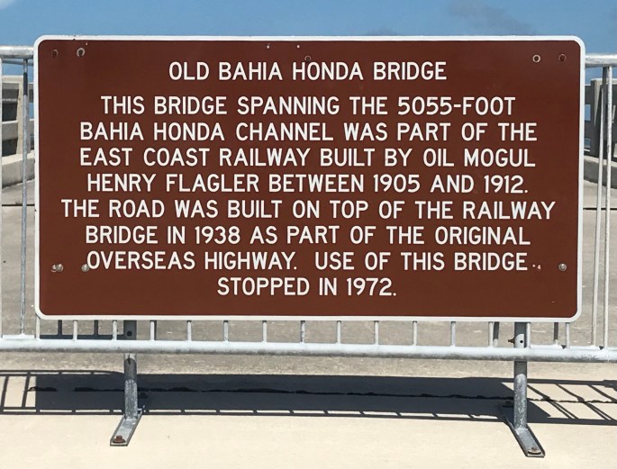
Part of the park was the railroad bridge topped with the original oversees highway. Obviously damage has occurred through the years and it is no longer traversed.
The state park was founded in 1961 and covers virtually all of the uninhabited island.
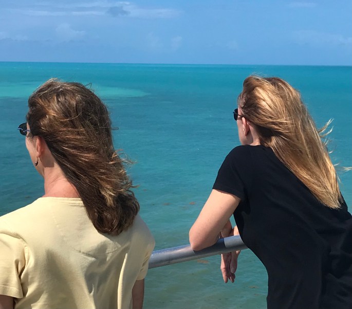
BUT………I saw people at the top of this bridge trail and HAD to make the climb.
Seeing this at the top……………………not really surprised since there was a huge gap seen in an earlier photo above.
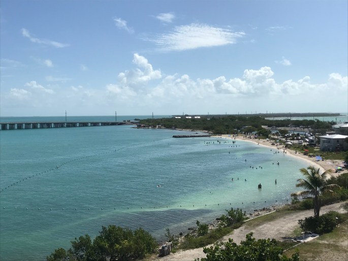
Being at the top of the bridge trail was also a chance to get a great shot of the beach area.
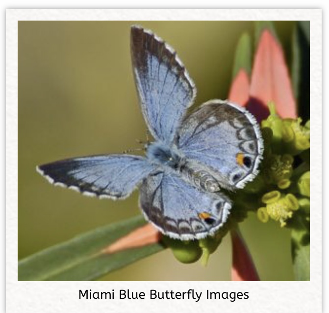
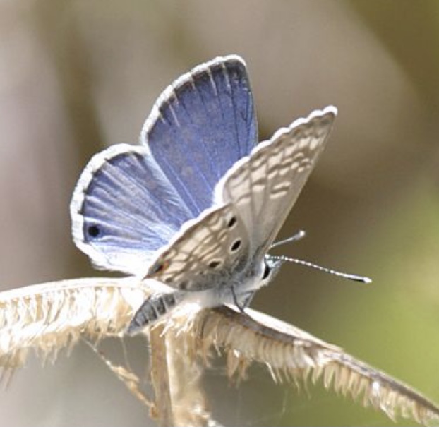
Digging deeper via the internet about this state park, I also found some interesting info about a rare butterfly, called Miami Blue. I read nothing about it while at the park. It was thought extinct as a result of Hurricane Andrew in 1992, but was discovered in this park in 1999. Research along with propagation of the species is ongoing to spread the butterfly.
Going further up the keys we stopped at…………..
John Pennenkamp Coral Reef State Park. This is the first underwater park in the US, established in 1963. The park is 25 miles in length and extends three miles into the Atlantic ocean.
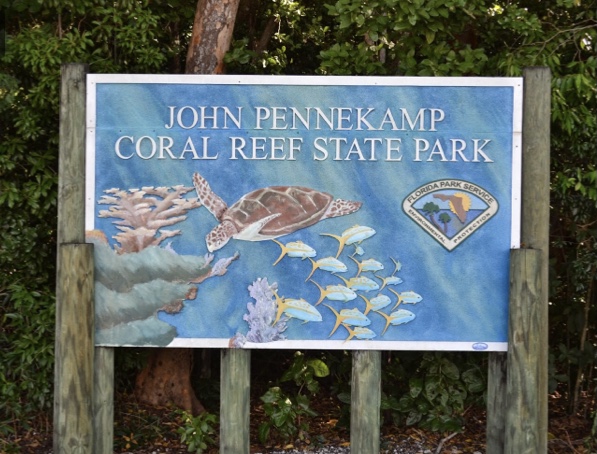
Original plans in the 1930s was to designate the reef off Key Largo for protected statue and incorporate it into the National Everglades Park. Opposition from various sources stopped the plan that included the Key Largo reefs although the national Everglades Park was established. It wasn’t until the 1950s that citizens became concerned (again) about the destruction (I read the reefs were being hammered, chiseled and even dynamited for coral souvenirs) that another push was made to save the reefs. The man which would eventually be the assistant editor of the Miami Herald, John Pennenkamp, teamed up with others for the fight. In 1960 the reef was designated as federally controlled and protected area. When land and access to US 1 was acquired in 1963, it became a State Park.
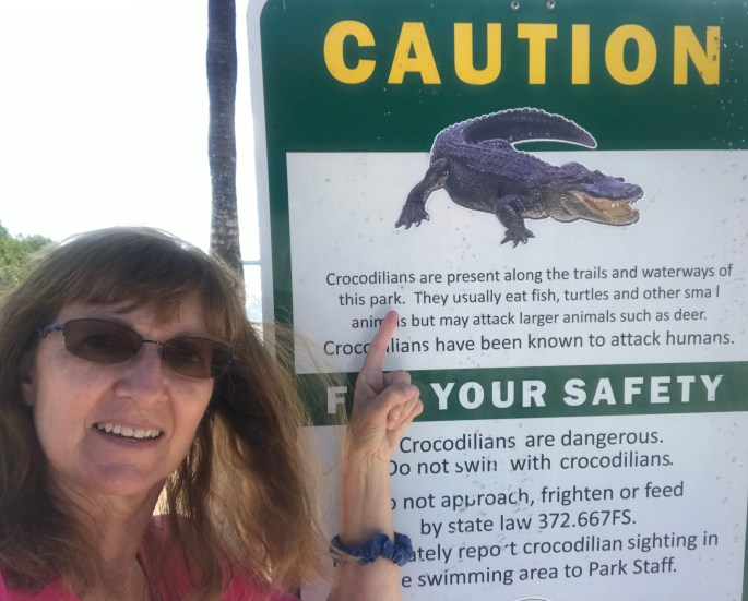
Everyone here is planning on snorkeling and/or taking their glass bottom boat to see the reefs. Not me. I had a very bad experience in the 1980s and to this day get panicky if I put on a snorkel and mask. We drove around the park and found a quiet lagoon and this sign. We worry about alligators in central Florida, now add in the American crocodile down south.
They have this fabulous 30K gallon saltwater aquarium and six smaller aquariums along with a natural history exhibit about the park’s biological communities and ecosystems. A theater shows nature films and videos. And it was closed……….for renovations. Really? Really! Could that have been down months ago when no one was traveling – just saying. Yep, not much time was spent in this park when we visited.
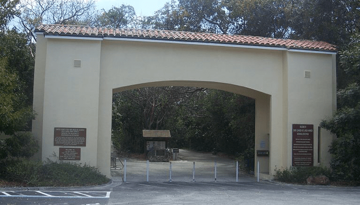
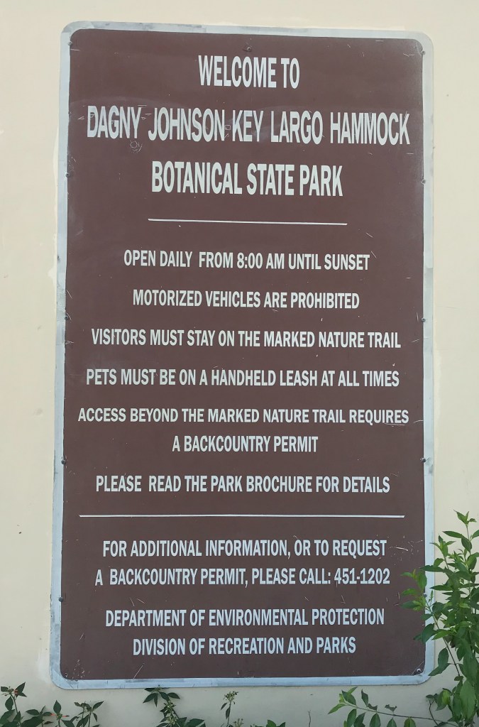
The last state park we visited was the Dagney Johnson Key Largo Hammock Botanical State Park. Yikes! That was a mouthful. Parking is outside of the entrance.
It was established in 1982 when land was acquired by Florida Conversation and Recreational Lands Program. The park occupies about a third of the island of Key Largo, covering over 2400+ acres. It is home to 84 protected species of plants and animals. It’s the largest track of the tropical hardwood hammock in the US. Two animal species are only found on Key Largo: Key Largo Woodrat and the Key Largo Cotton Mouse.
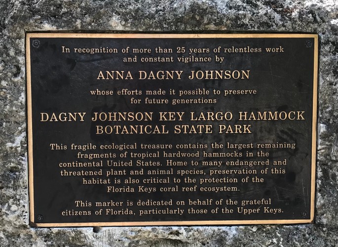
The name honors a local environmental activist who from the 1970s – 90s led several environmental organizations that fought to stop development that was planned – Port Bougainville – a planned community of 15 hotels and 2000+ condos. Google it – I did and went down a rabbit hole reading more and more articles about it.
Okay, now I need to admit something. Until I read the plaque after getting home……….never knew this was named after a female. Oops.
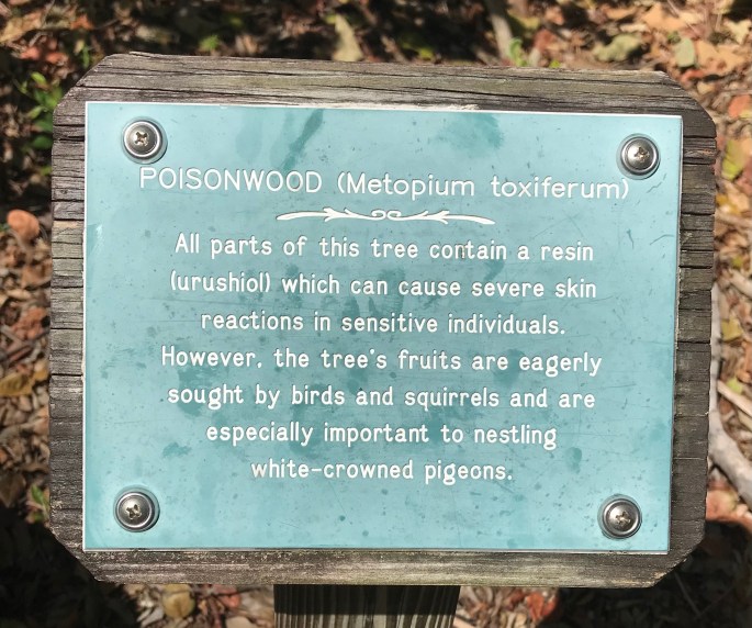
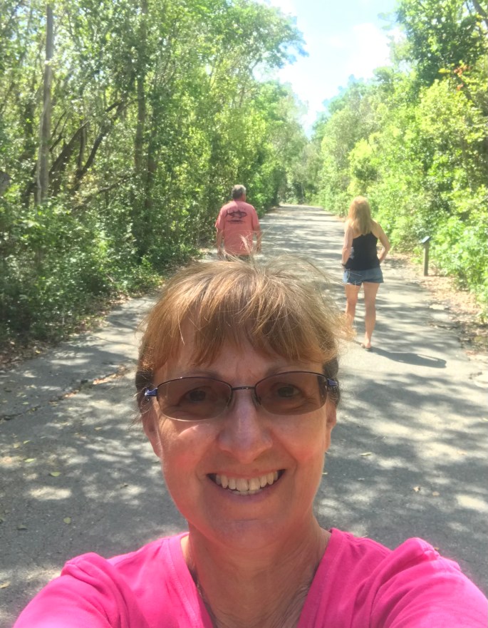
As seen in the first photos above, parking is all outside of the archway and the park is pretty much self-service – no park rangers stationed here. It is about the nature trails – approximately 6 miles with several loops involved. There were several signs like this posted along the trail, but this one stuck out – Poisonwood. Yep, it’s a pretty bad tree. People have been known to go to the hospital from a rash after rain water dripped off the tree. People also been affected by burning smoke from this tree. It does have some good qualities as noted below – food source.
We walked down the main pathway and found this arbor area. Can I say this park looked deserted, felt deserted and was so empty, kind of felt creepy.
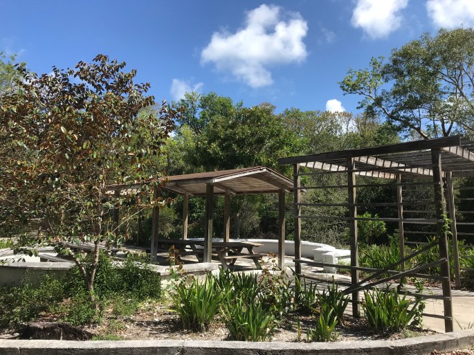
I was able to grab this quick photo of our walk. It was a nice wide, paved trail. I’ll also admit……….we didn’t walk very far. This day the keys were hot, muggy and with all of the trees, not much air movement. We reached the arbor area and said ‘We’re good’.
We did several r.e.a.l.l.y cool things later in the week and they will be in a post – very soon.

We always loved visiting the Keys..
LikeLike
While much more development exists, the quirkiness still exists. Might have to dig a bit deeper to find it – but it’s there. Thanks for commenting.
LikeLike